

Hiking Southern Utah: Pine Park
Trail name: South Boundary Trail (lower portions)
Location: West of Enterprise near the Nevada border
Difficulty: Easy (unless doing the complete trail — not recommended)
Length: 1/4–1/2 mile
Elevation gain: Minimal
Average time: 1–2 hours
Family-friendly: Yes
Dog-friendly: Yes

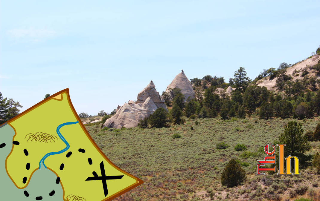
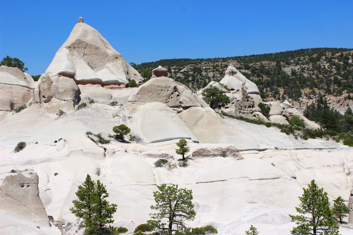
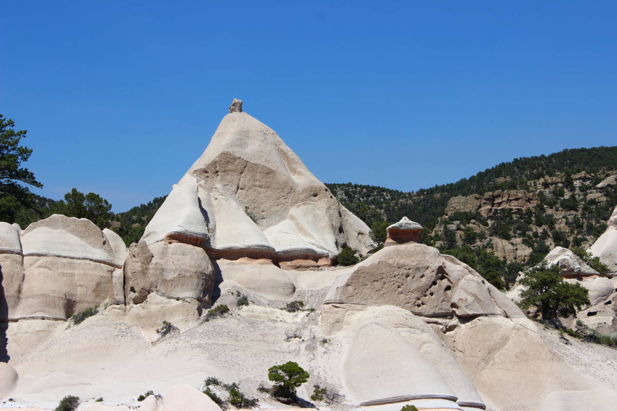
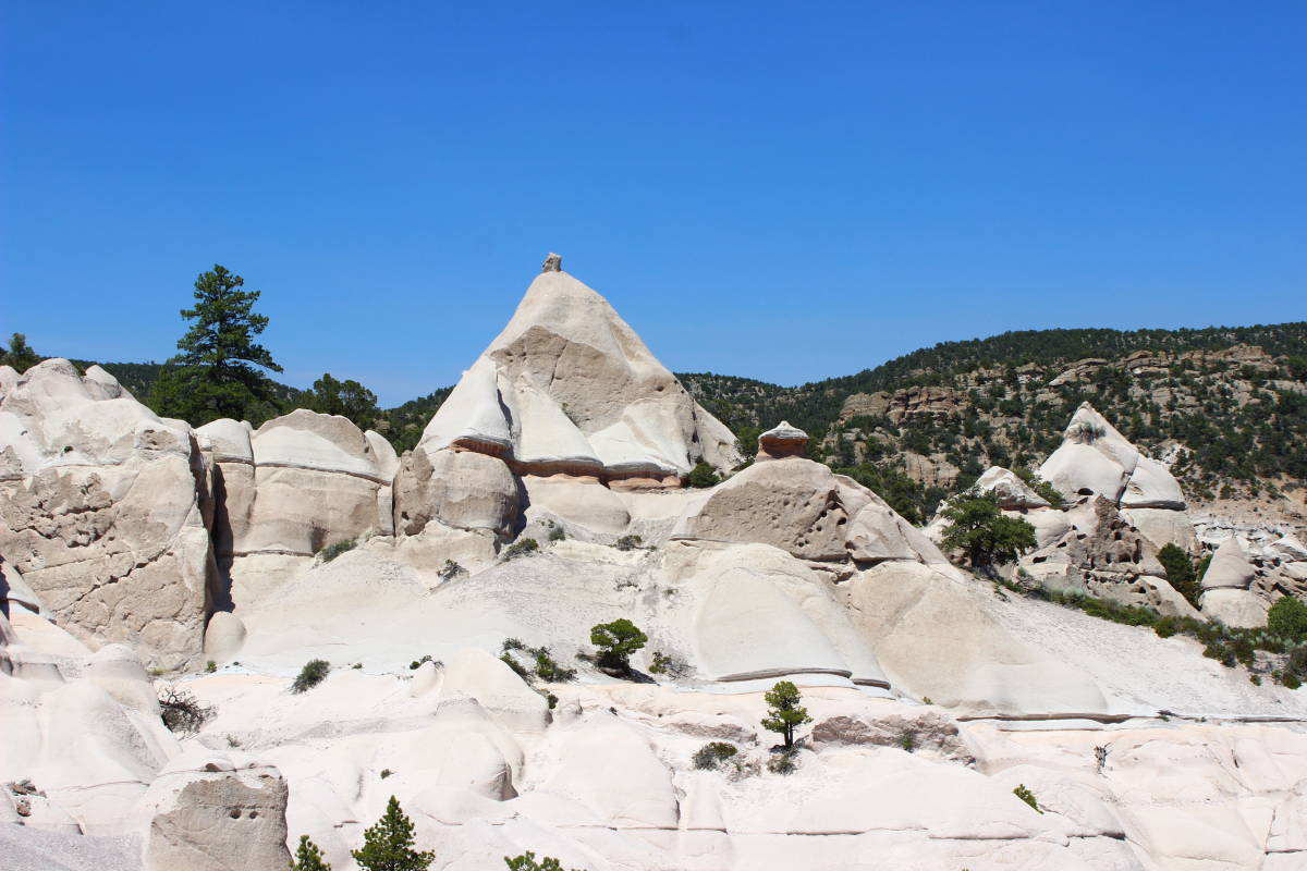
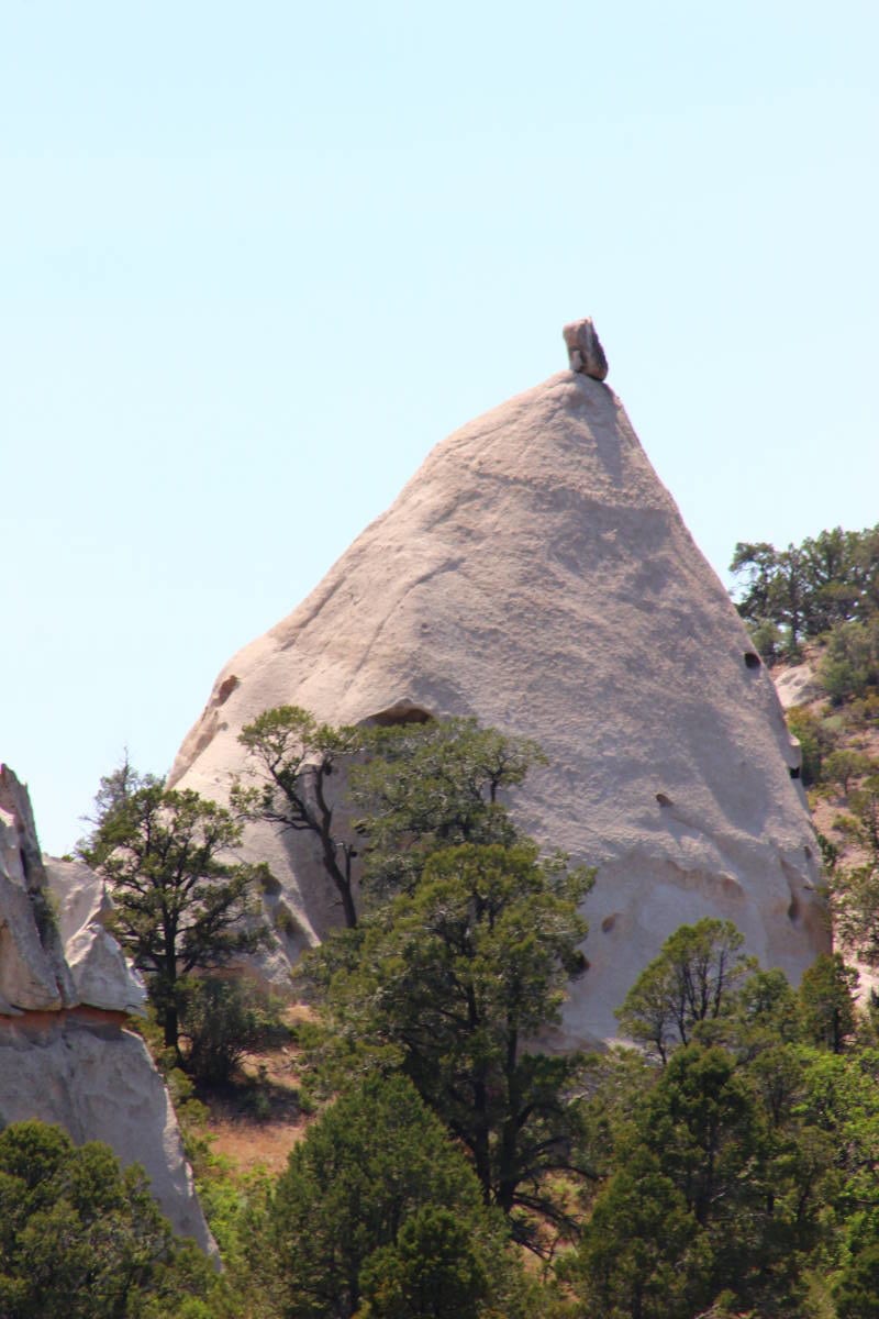
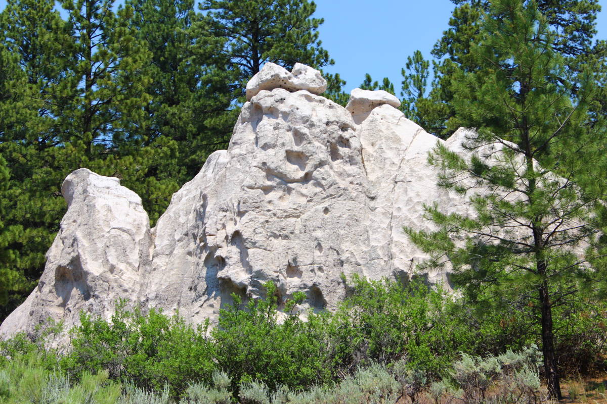
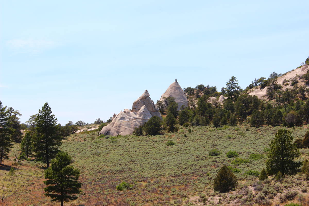
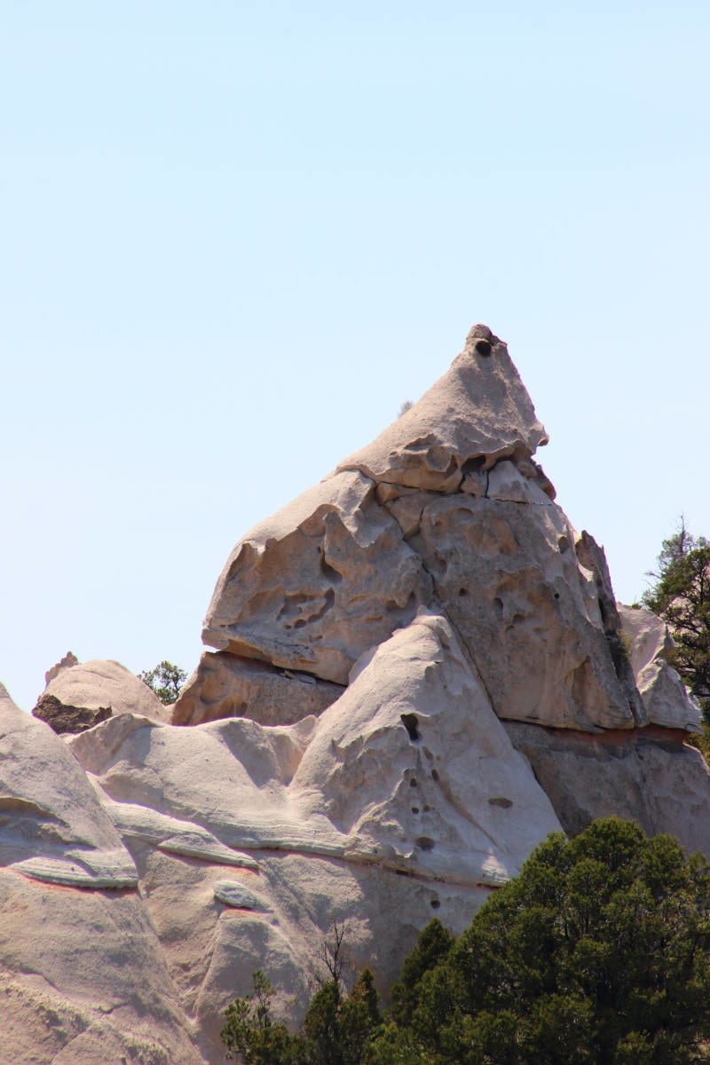
Pine Park is a long-forgotten wonderland of white volcanic pinnacles and cones (very reminiscent of the fairy towers of Cappadocia, Turkey) located in a veritable wilderness west of Enterprise. While this hike is a long ways from civilization, it is a terrific place to spend an afternoon exploring. The trail listed here is the South Boundary Trail, but the recommendation is to just explore the lower reaches of the trail around the “park” itself. This is not a park in any true sense of the word. There are a few picnic benches scattered around the parking area and some spots for tent camping, but that is about it. Even though Pine Park itself is only 20 or so miles from Enterprise, it is a remote place. Be sure to let someone know where you are going and that your vehicle is in good operating condition and has at least one functioning spare tire.
Access: To get to Pine Park, drive approximately 38 miles north from the junction of Bluff Street and St. George Boulevard to the “T” Junction in Enterprise. Turn left on State Route 219 (Main Street), and drive west for approximately 16.5 miles, continuing as the road becomes Crestline Road. Take a left on Forest Road 001 (White Rocks Road) and drive for 9.5 miles to the park. Just before you reach the parking area, take note of a spectacular viewpoint of conical peaks — you will be returning to this spot. The last 100 yards or so are rough but still passable for a passenger car. Note that you will pass the upper trailhead for South Boundary Trail. Ignore this and continue to the parking area. The South Boundary Trail is at the north end of the parking lot.
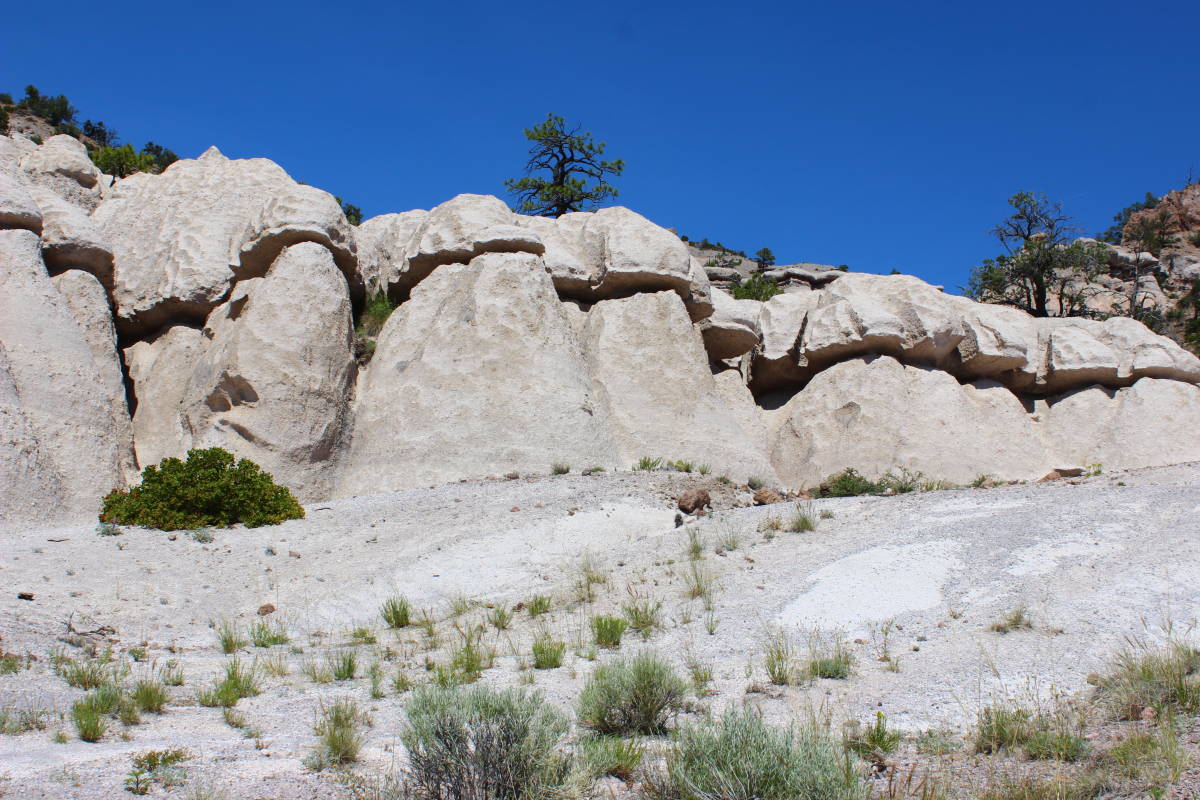
Before heading onto the trail, take the time to explore the crags and boulders around the parking area. There are numerous spots to explore in the vicinity, and young climbers will delight in the easily accessible rock formations. Just keep a close eye on them, because some of these crags are tall enough to be dangerous.

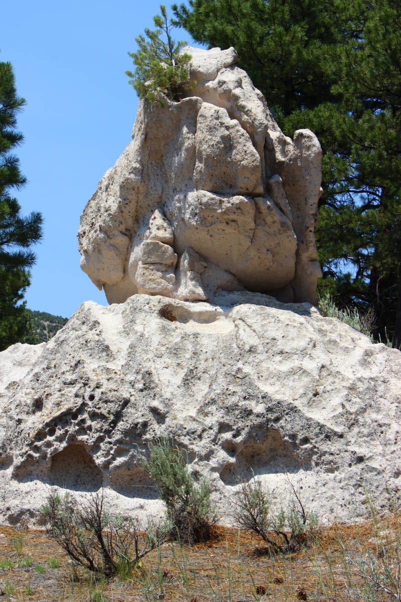
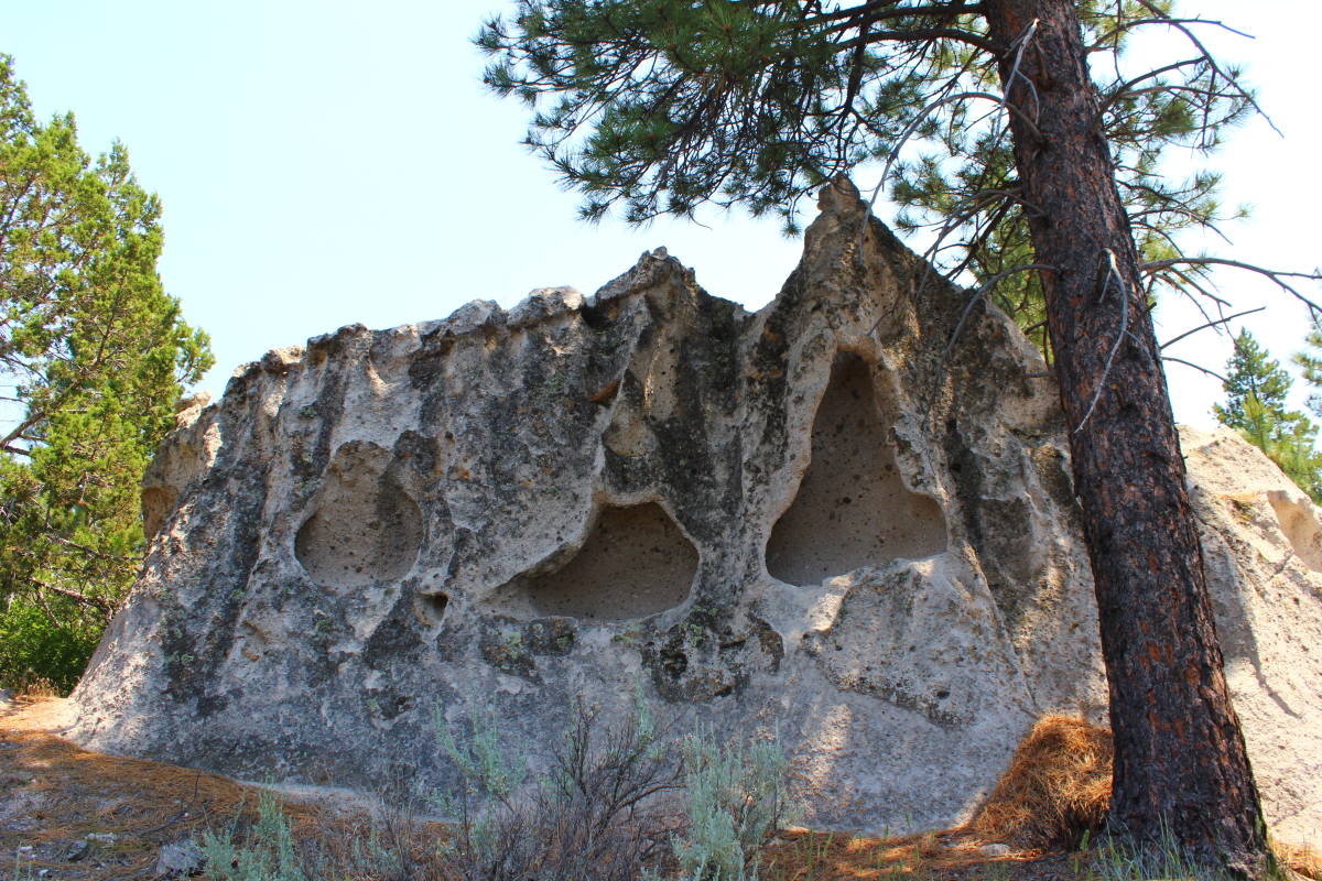
After exploring here, head north on the trail, again taking time to wander around and explore the numerous rock formations that dot the area. In particular, there is one rock close to the trail that has a unique chimney shape and a couple of fun pockets to explore. This is a place to take your time and wander and explore. The trail itself is indistinct in places and trees have fallen across it in others. After a short distance, the trail fades in a marshy area, and while it can be picked up again, it is almost not worth it beyond that point.

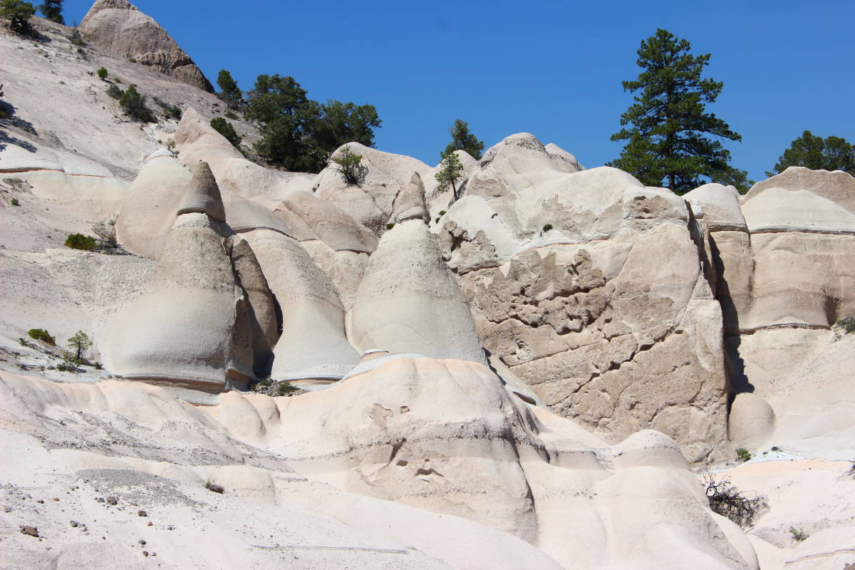
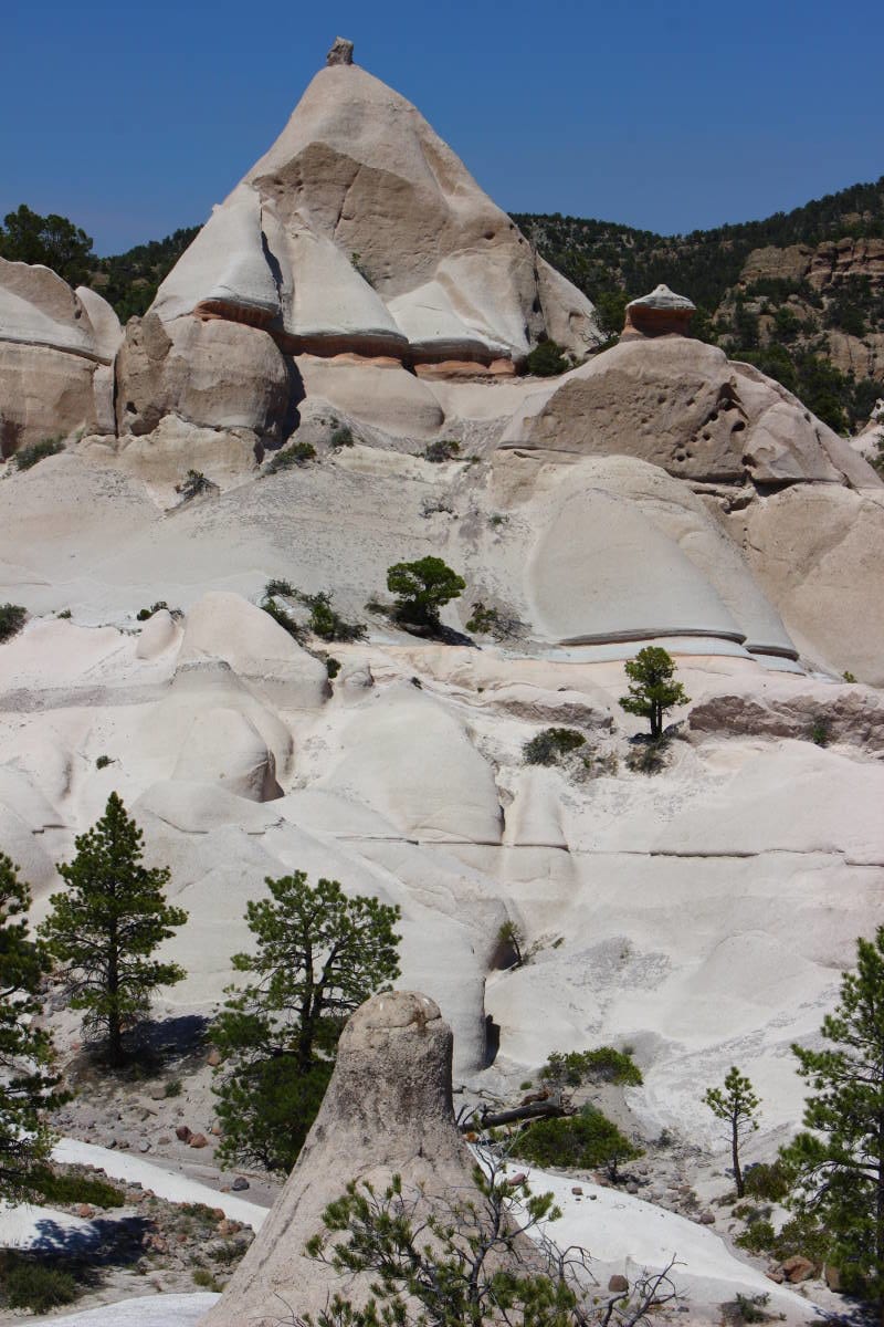
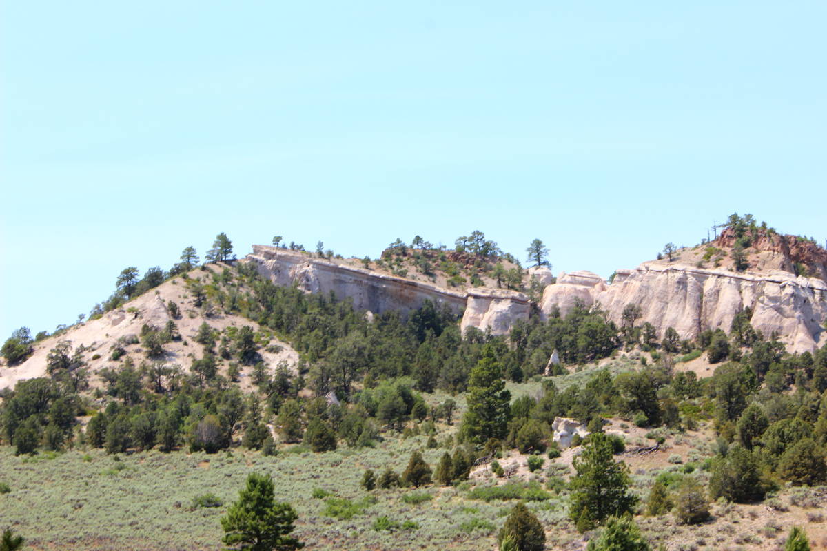
When finished exploring the area, return to the car and drive back to the viewpoint you passed along the way. Park on the side of the road and look for a way down into the bowl below. It can be steep, so exercise caution on the descent. In many ways this is the most impressive section of Pine Park. The hoodoos, which were visible from the trail, are much more spectacular here, rising several hundred feet above the bowl. Large Ponderosa Pines are completely dwarfed by the crags here. This particular spot is awe-inspiring and spectacular: a place to explore, a place to contemplate the forces of nature and the wild beauty of Utah. When finished, scramble back up the road.

If you’re interested in doing the longer version of the South Boundary Trail, the ideal way to hike it is to use a car shuttle, parking one vehicle at the upper trailhead and another at Pine Park itself. Doing it this way makes for a three-mile hike with a little over 600 feet of elevation loss. Of course, if you’re opting to use a single vehicle, the roundtrip becomes six miles with 600 feet of loss and gain.
Articles related to “Hiking Southern Utah: Pine Park”
Hiking Southern Utah: Confluence Park is not your typical hike


Does CalTrans city bus service go to this destination from Switchpoint? Thank you, Lisa McDermid